Wilton
Explore both sides of the Norwalk River! The East side offers scenic off-road trails and boardwalks, while the West side follows quiet roads through town. An additional mile will extend eastward from Skunk Ln to Pimpewaug Rd in 2025!
ACTIVITY
Roll, Bike, Walk, Bike
LENGTH
6.2 miles, Loop
SURFACE
Gravel/Crushed Stone, Boardwalk, Paved/Cement
PETS
Permitted on leash
FEES
No

Trail Section Activity
DESCRIPTION
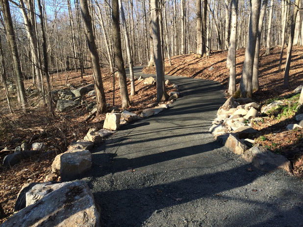
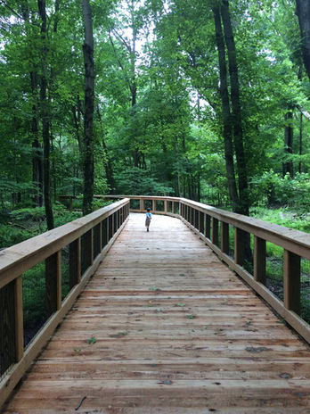
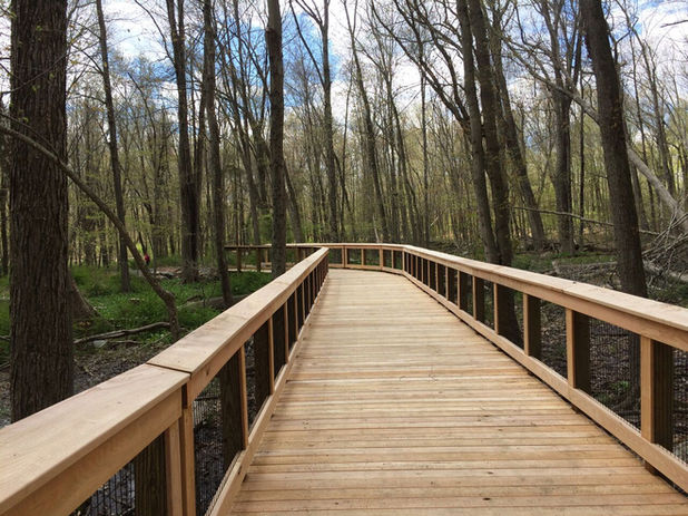
From the southern trail head, cross Route 7 to access the Wilton Loop East trailhead. The east side trail extends approximately 2.4 miles off-road from Wolfpit Road and Route 7 to just short of Skunk Lane. This off-road section features a beautiful elevated, accessible boardwalk through wetlands, and stone dust surface for the remainder. Look out for the Rock Memorial Installation. Pre-construction is underway north of Skunk Lane to eventually connect near the Cannondale train station. Continuing north on-road, please note: Skunk Lane is a busy road and care should be taken while walking, running, and cycling.
From the southern trail head, a 0.4 mile section, Quarry Pond Trail is accessed at the back of the commuter lot by going southward over a refurbished car bridge. This section offers great views of the Norwalk River.
From the southern trail head, the Wilton Loop West is accessed by proceeding along Route 106/Wolfpit Road to the center of town. Currently, the west side trail is mostly on or along roads, with paved or stone dust surface. A partly finished section of the loop runs from Wolfpit Road and Route 7 to Schenk’s Island, and then to the town center along River Road. Another access point for longer stretches of the west side trail is over the new pedestrian bridge from the Wilton Metro North train stop. This bridge crosses over the tracks and leads right onto the NRVT at Merwin Meadows Park. This section of trail is often utilized by the Wilton High School track teams, it continues north by the area of the Dana Dam take-down, and then hits the north end of the loop in Allen’s Meadows at Olmstead Hill Road. There are beautiful views of the Norwalk River from this section and the remaining sections meander through old woodlands and wetlands with some boardwalks.
All sections of the trail are clearly marked by NRVT signs. Dog waste stations are available on the eastern sections at Gaylord Drive, Autumn Ridge, and Twin Oak Lane. The success of substantial work by the Norwalk River Watershed Association and local corporate volunteers to combat invasives and restore natives can be seen along the areas of the Autumn Ridge parking lot. When completed, the NRVT in Wilton will be 10 miles total.
Trail section info courtesy of our friends at CT Trail Finder. Thanks for helping us share the journey!
FRIENDLY REMINDER
Be kind, say hi! Greeting other trail users builds community. Dog owners are responsible for disposing of pet waste. Receptacles available at Gaylord Road, Autumn Ridge, Twin Oaks, and Chipmunk Lane.
DIRECTIONS
The NRVT Wilton is best accessed from its southern trailhead.
// SOUTHERN TRAILHEAD
From Route 15S, take Exit 41 and turn left onto Wilton Road/Route 33 west towards Wilton center, or take Exit 40B and follow Main Ave north until it meets Route 7 north. Find a paved parking lot at the intersection of Route 7 and Wolfpit Road/Route 106 in Wilton.
From Route 15N, take Exit 39B and merge onto Route 7 north. Find a paved parking lot at the intersection of Route 7 and Wolfpit Road/Route 106 in Wilton.
// NORTHERN TRAILHEAD
There is gravel parking at Allen Meadows Park on the east side of Route 7 between Cannondale Road and the Wilton YMCA.
EAST SIDE - AUTUMN RIDGE DRIVE
From Route 7 across from the Wilton Crossing Business Center, turn east onto Sharp Hill Road. Travel for about 0.8 miles and then turn left onto Autumn Ridge Drive. Parking and trailhead are on the right.
From Route 53, turn east onto Cedar Street/Chestnut Hill Road and continue on Hurlbutt Street. Turn left onto Sharp Hill Road, and take the third right onto Autumn Ridge Drive. Parking and trailhead are on the right.
EAST SIDE - TWIN OAK LANE
From Route 7 between Pimpewaug and Station Road, turn east onto Powderhorn Hill Road. Head straight to Twin Oak Lane where the trailhead is at the end of the cul-de-sac.
EAST SIDE - SKUNK LANE
From Route 7S, take Cannon Road and turn right onto Pimpewaug Road. Take the 3rd left onto Skunk Lane. The trailhead is on the right just before the road bends. Skunk Lane has roadside parking only. There is NO parking on Briardale Place.
From Route 7N, stay right onto Pimpewaug Road, then turn right onto Skunk Lane. The trailhead is on the right just before the road bends. Skunk Lane has roadside parking only. There is NO parking on Briardale Place.


